

Out of this world!
Come and experience total peace and quiet in spectacular unspoiled nature.
Beautiful hiking trails. Catch a few mountain-lake trout for supper.

Langisjór: House and fishing!
The only house on Langisjór lake and the tranquility is wonderful!
House which stands on a peninsula south by the Langisjór lake for rent. Sleeping bag accommodation for 4 in beds and 2 on double sofa bed. Included in the rent are permit for fishing within Langisjór lake.
There are few things we need to inform you about before you start your journey to the cabin at Langisjór. You have to have a 4x4 jeep to go to Langisjór because you have to cross rivers.
The cabin at the lake Langisjór is placed in one the most remote places in Iceland or as we state on our web out of this world.
If you prefer to be in remote place away from traffic you are going to the right place. But there is always some trade-off in being out of this world. There are for example no mobile connection and you cannot expect to meet many other travellers. There are extremely limited access to all kinds of modern infrastructures like electricity, hot and cold water and more.
Get familiar to Safe Travel https://safetravel.is/ and remember that you are traveling on your own with limit access to support and assistant.
This means that you will not be able to use the shower and neither will you get hot water in the sink. But you can always get warm water though by heating it on the stove. You use cold water from Langisjór for the toilet and there is a hud near by there you can get your drinking water but you have to bring a container for the cold water.
The hud is headed up with gas.
You have to bring your one sleeping bag and clean the cabin before you go so the next customer will have a nice stay as well as you.
See pricelist.
More photos
Maps.
Google maps.
Gps coordinates: 64° 7,144'N, 18° 25,689'W (ISN93: 527.862, 401.918)

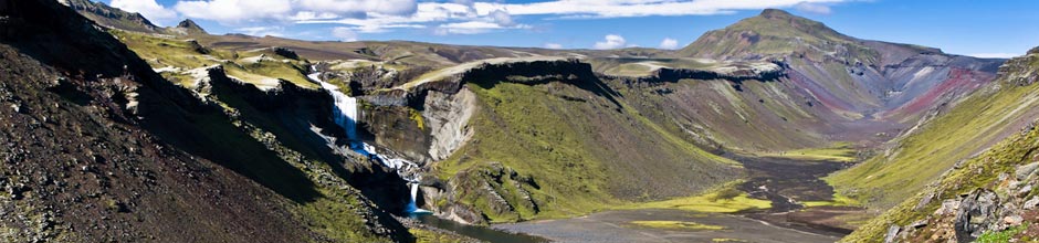
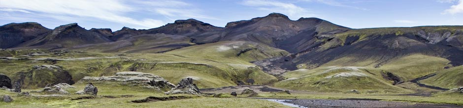
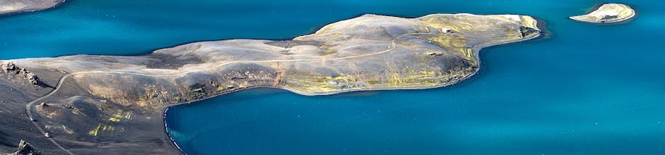
Landscape near Langisjór

About Langisjór and Sveinstindur
Langisjór is a large lake southwest of Vatnajökull. It is 27 square kilometers, 20 km long and 2 km wide where it is widest. Altitude is 662 m. and it stretches southwest from the glacier. East of Langisjór is the mountain range Fögrufjöll, there are many rock formations that lead into the water and cross into the fjords and bays. On the southern end is Sveinstindur which is named after Sveinn Pálsson, a physician and naturalist from Vík. Sveinstindur is 1092 m above sea level. It is relatively easy to walk up, so most people are able to get to the top with an increase of 400m. The view from the top is unique, it is said that if the weather is good you can see over á quarter of Iceland, from Öræfajökull in the east to Hellisheiði, Langjökull and Hofsjökull in the west. When looking over all of Langisjór the view is incomparable. To the right is Fögrufjöll with numerous lagoons between high and peaks. East of Fögrufjöll runs the glacier river Skaftá, which often crashes with catastrophic floods, which originate in Skaftárkötlum, which are close to Vatnajökull. East of Skaftá you can see Lakagígar, where the lava from Skaftáreldar flooded the lowlands in 1783, that is the third largest lava flow on earth since the last ice age.
It is popular to go on kayaking trips in Langisjór, angling is also available.


